This Page Was Updated On Tuesday, March 19, 2024

Then and Now

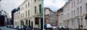
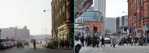
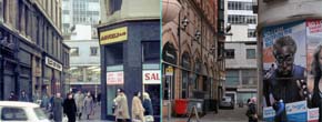
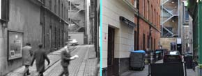
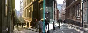
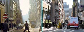
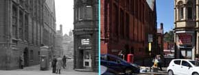
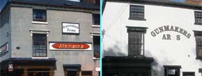
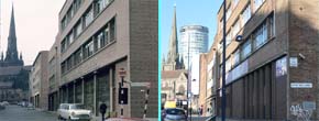
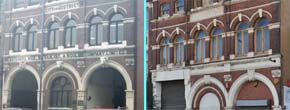
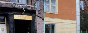
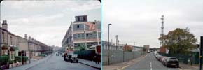
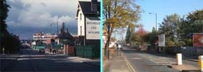
Birmingham has an ever-changing skyline, so on this page I have attempted to recreate scenes from older images from the same viewpoint - or as close as I could get to it. In some photos, things like trees, recently built walls, new road layouts, and road signs have obstructed the 'shot', in others it may have meant that to obtain a more precise comparison I would have had to stand in the middle of a busy road - sorry, but I have no intention of doing that. In some photos the view has changed very little, in others, it has changed so much that it is almost unrecognisable.

For Copyright information regarding this collection and slideshow please Click/Tap Here This Icon Tells You That The Link Opens In A New Window / Tab

Click/Tap Thumbnail to enlarge image/start slideshow.

Colmore Row At Victoria Square
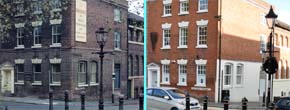
Looking at Waterloo Street from Colmore Row
Waterloo Street, viewed from its junction with Temple Row
Bennetts Hill As Viewed From Colmore Row
Bennett's Hill, viewed from its junction with Waterloo Street
Bennetts Hill
Navigation Street
Pinfold Street
Hill Street
New Street Station
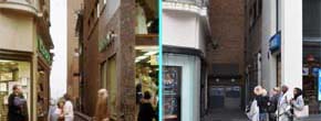
Warwick Passage, as viewed from Corporation Street
Temple Passage
Needless Alley, as viewed from Temple Row West
Temple Street, as viewed from Temple Row
Cherry Street as view from Temple Row
Coleridge Passage connects Corporation Street to Steelhouse Lane
Accident Hospital, Children's Hospital on Steelhouse Lane
Steelhouse Lane Police Station
Central Fire Station with Aston University in the background
Bullock Street
Aston University, Gosta Green
Curzon Street Station
The Gunmakers Arms
Price Street in Birmingham's Gun Quarter
Hylton Street, off Vyse Street (west side)
Hylton Street, off Vyse Street (east side)
Caroline Street and Regent Parade
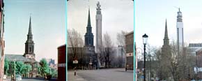
Saint Paul's Church with the BT Tower in the background, as viewed from Caroline Street
Ludgate Hill
Ludgate Hill
Saint Paul's Square
Sheffield Smelting Company
Newhall Street
Birmingham Assay Office
Elkington's Electroplating Works
High Street, looking towards its junction with Bull Street, Dale End, and Albert Street
Castle Street
High Street looking towards Dale End and Bull Street
Carr's Lane from Moor Street, looking towards High Street
Moor Street Station with Selfridges in the background
Smallbrook Queensway, shows the walkway that joins the Bull Ring with New Street Station
Severn Street
Hurst Street, Hill Street, and Smallbrook Queensway
Holloway Circus
Holloway Head
Saint Martin's Lane
Moat Lane, off St Martins Lane
Digbeth High Street
Dudley Street
Edgbaston Street, looking towards St Martin's
Looking towards The Bull Ring from Digbeth
Moat Lane
Moat Lane
Moat Row
Butcher's Hide, Skin, Fat and Wool Co. Ltd.
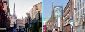
Digbeth High Street with the Rotunda in the distance
Digbeth High Street near the Custard Factory
The Irish Centre now, but it was a restaurant
The Irish Centre with the Custard Factory on the left
The Old Crown, the oldest pub in Birmingham
A workshop and now a college on Floodgate Street
Looking along Milk Street towards High Street Digbeth
River Street as viewed from Floodgate Street
E.Steiner Ltd on Bradford Street
Kirby Beard & Co Ltd replaced by on Kingfield Heath on Bradford Street
The Shepherds Rest on Bradford Street
Holy Trinity Church in Camp Hill
Holy Trinity Church at Camp Hill
The BSA at Armoury Road
Warwick and Birmingham Canal
The Lodge on Golden Hillock Road
BSA in the Distance
Five Ways House
Calthorpe Road and Harborne Road Junction

Cookies & Privacy     Terms & Conditions     Site Map     Links & Thanks     Contact Me

This Site is Owned, Designed, Constructed, and Maintained by Dave Black