Then and Now Images - B5 Postcode
Some locations on this page are: Dudley Street, Edgbaston Street, High Street Deritend, Moat Lane.
At the bottom of each page there are buttons to take you to a specific postcode, or just use the 'Previous' and 'Next' buttons to navigate this collection.
For Copyright information regarding this collection please Click/Tap Here ![]()
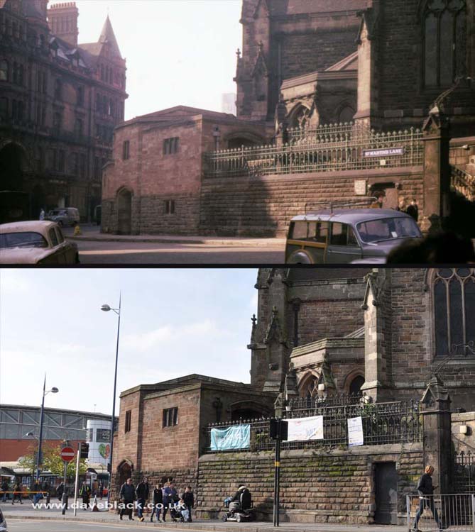
This section of road was once called Saint Martin's Lane, it ran for a few yards into what is now Edgbaston Street. Although not clearly defined, it is the junction of Park Street, Moat Lane, and Edgbaston Street.
Upper Image: Author - John Ball, Copyright - John Ball.
Upper Image Date: 1963.
Lower Image Date: 30/10/2019.
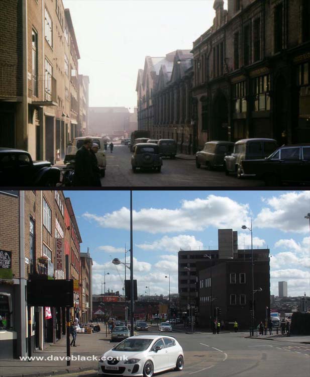
Moat Lane, off St Martins Lane.
Upper Image: Author - John Ball, Copyright - John Ball.
Upper Image Date: 1963.
Lower Image Date: 16/03/2020.
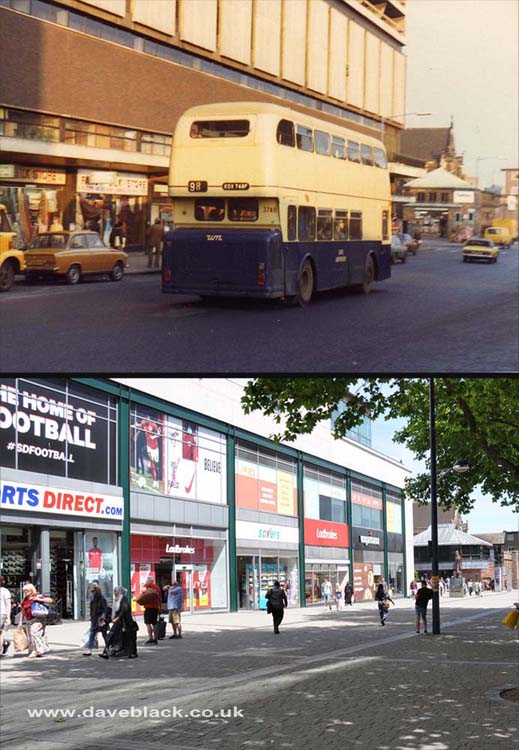
Edgbaston Street - Now pedestrianised.
Upper Image: Author, and Copyright status not known.
Upper Image Date: Not known - possibly mid 1980's.
Lower Image Date: 24/06/2018.
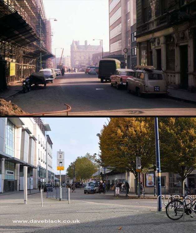
Edgbaston Street, looking towards St Martin's, in both images The Bull Ring Tavern is just visible in the distance.
Upper Image: Author - John Ball, Copyright - John Ball.
Upper Image Date: 1963.
Lower Image Date: 30/10/2019.
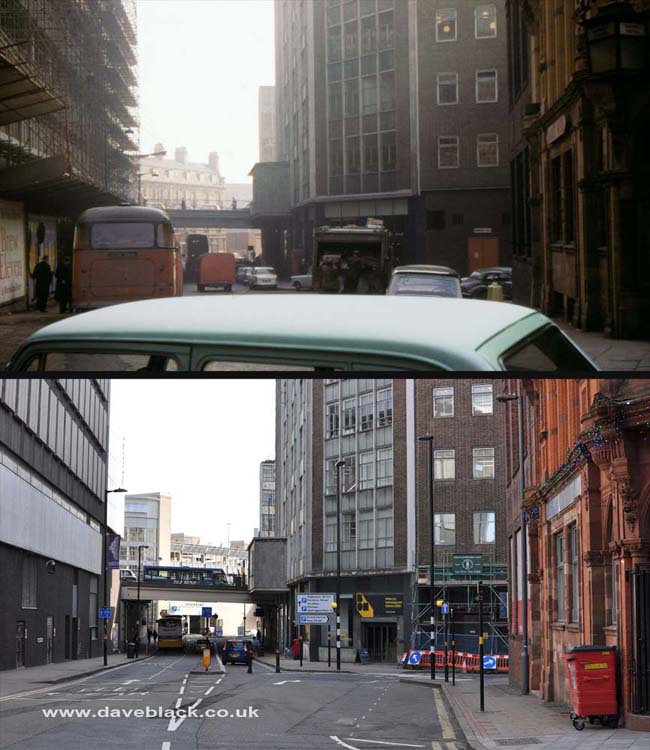
Dudley Street, looking towards its junction with Edgbaston Street.
Upper Image: Author - John Ball, Copyright - John Ball.
Upper Image Date: 1963.
Lower Image Date: 05/02/2020.
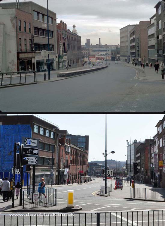
High Street Deritend - Looking towards Digbeth, Saint Martin's Church behind me.
Upper Image: Author - Phyllis Nicklin, Copyright - MLA West Midlands and the University of Birmingham.
Upper Image Date: 15/03/1968.
Lower Image Date: 07/05/2018.