Then and Now Images - B3 Postcode
Some locations on this page are: Caroline Street, Colmore Row, Ludgate Hill, Saint Paul’s Square.
At the bottom of each page there are buttons to take you to a specific postcode, or just use the 'Previous' and 'Next' buttons to navigate this collection.
For Copyright information regarding this collection please Click/Tap Here ![]()
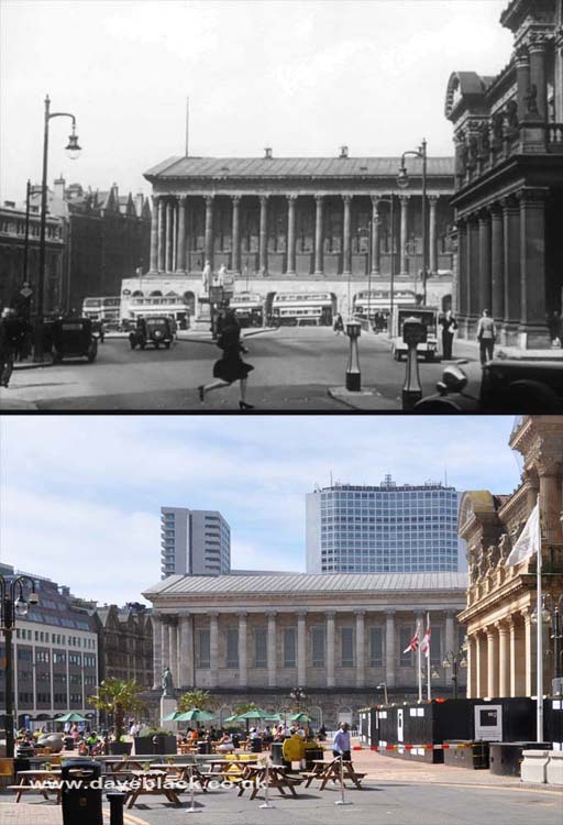
Birmingham Town Hall and Victoria Square - as viewed from Colmore Row, Birmingham City Council House is on the right.
Upper Image: Author, and copyright status not known.
Upper Image Date: Not Known, perhaps late 40's/early 50's.
Lower Image Date: 08/09/2021.
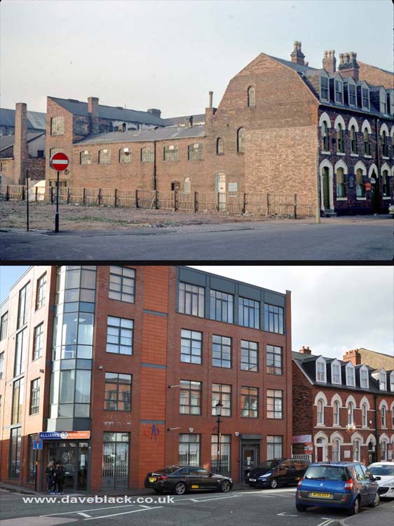
Caroline Street: The jewellery workshops were dedicated to engravings, polishing, enamelling, optical works, jewellery and diamond setting.
Upper Image: Author - Phyllis Nicklin, Copyright - MLA West Midlands and the University of Birmingham.
Upper Image Date: 09/11/1968.
Lower Image Date: 22/10/2018.
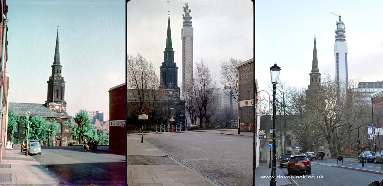
Saint Paul's Church as viewed from Caroline Street.
Left & Middle Image: Author - Phyllis Nicklin, Copyright - MLA West Midlands and the University of Birmingham.
Left Image Date: 29/06/1963.
Middle Image Date: 01/04/1967.
Right Image Date: 08/01/2019.
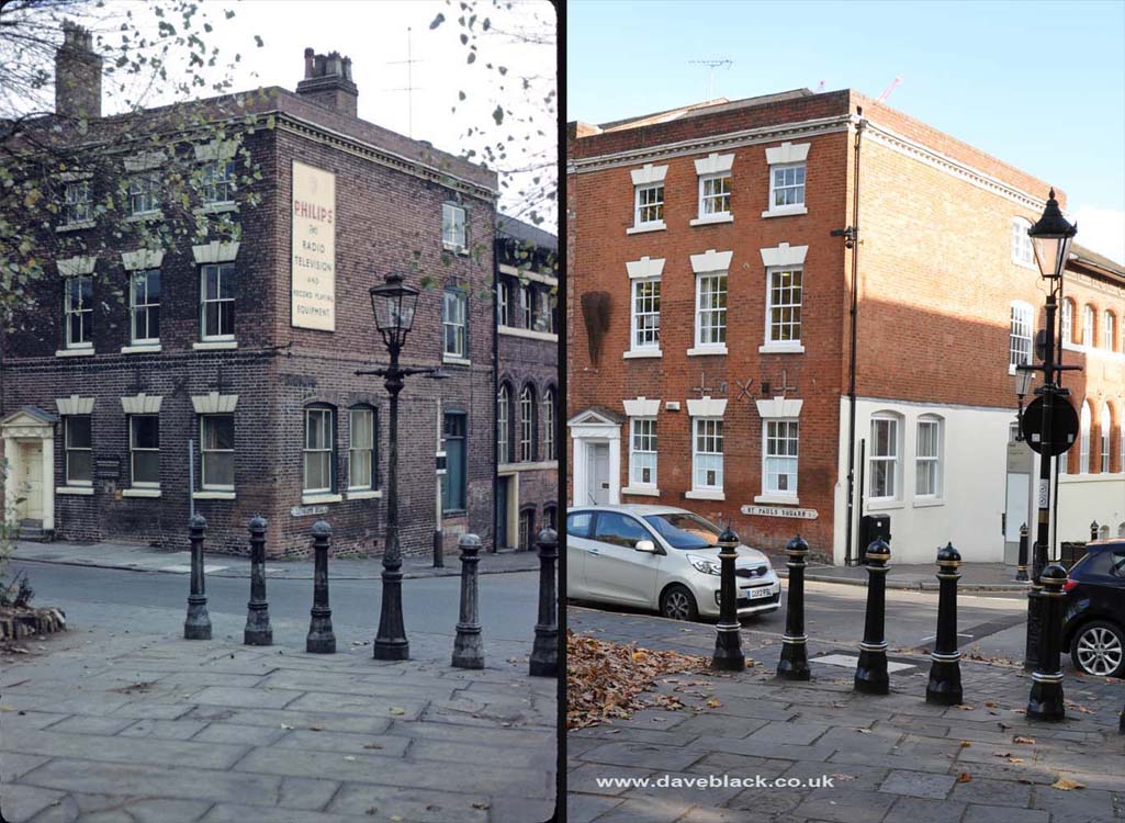
Ludgate Hill is to the right; Mary Ann Street (part of Saint Paul's Square) is to the left. Photo taken in the grounds of Saint Paul's Church.
Left Image: Author - Phyllis Nicklin, Copyright - MLA West Midlands and the University of Birmingham.
Left Image Date: 15/10/1960.
Right Image Date: 22/10/2018.
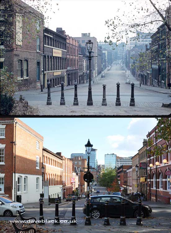
Ludgate Hill as viewed from the grounds of Saint Paul's Church.
Upper Image: Author - Phyllis Nicklin, Copyright - MLA West Midlands and the University of Birmingham.
Upper Image Date: 15/10/1960.
Lower Image Date: 22/10/2018.
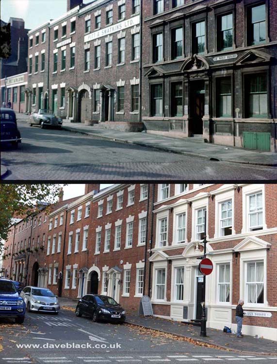
Old workshops in Saint Paul's Square have been renovated; the single storey building has been replaced with a hotel and restaurant.
Upper Image: Author - Phyllis Nicklin, Copyright - MLA West Midlands and the University of Birmingham.
Upper Image Date: 29/06/1953.
Lower Image Date: 22/10/2018.